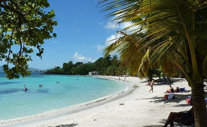
Hikes in Martinique
For travelers who prefer a little more action, there’s plenty of hikes with a range of difficulty levels. And they all offer stunning scenery and beautiful views. Discover tropical forests, and refresh yourselves with a dip in waterfalls and rivers.
Mount Pelée
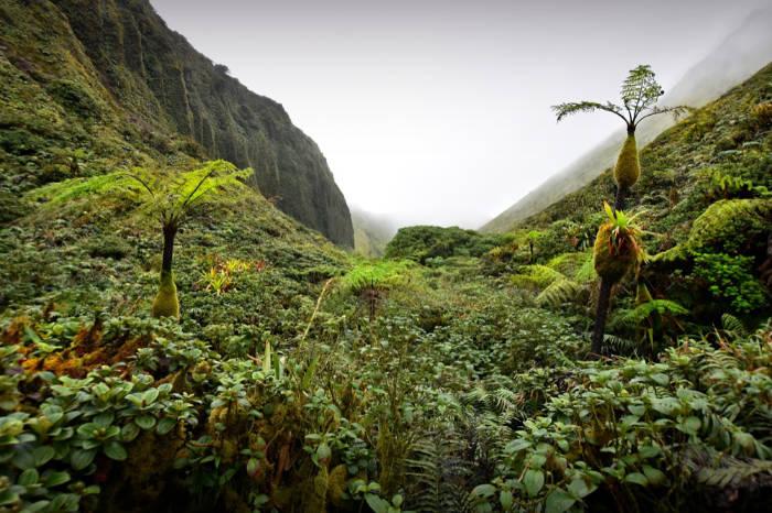
Mount Pelée, a dormant volcano, is the highest point on the island (1397m) and one of the most popular hiking options in Martinique. There are several ways to get there, you can start in either Morne-Rouge, Prêcheur or Grand-Rivière. The shortest and the most common way however, is the Aileron Trail which starts in Morne-Rouge. From Morne-Rouge, go in the direction of Ajoupa-Bouillon and then follow the signs leading to “Montagne Pelée” until you arrive at the parking lot.
The first part of the trail takes about one hour on an uphill path until you arrive at the crossroads. From here, head to the right towards “2ième Refuge” (2nd station) around the caldeira or straight to “Le Chinois’’which is the highest point.
The climb to Mount Pelée is an exceptional experience. The nature is different here than in the other parts of the island, as there are no trees, only bushes and various plants. From the top there is an amazing view of the whole island, from the Caribbean Sea to the Atlantic Ocean. Decent physical condition is advised. Bring solid shoes, a jacket and check the weather forecast beforehand in order to have the best experience.
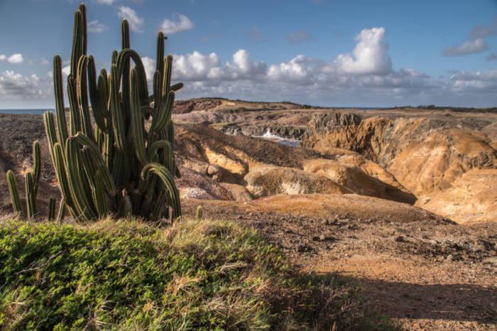
Savane des Pétrifications
La Savane des Pétrifications is located at the end of the Sainte-Anne Peninsula at the southern point of Martinique. The place owes its name to many petrified trees and other pieces of wood. It looks like a small desert area placed in lush, tropical vegetation and the trail begins in an undergrowth adjoining the beautiful beach of Anse à Prunes. Take the small wooden bridge across the water and keep walking onwards. This site offers a spectacular landscape reminding you of the moon. You will be surrounded by many cacti and stones of various shapes. The path is mostly flat with almost no shade. It is essential to take a lot of water, sun lotion, glasses and a hat.
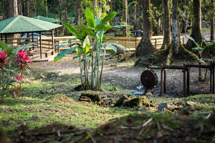
Coeur Bouliki (Circuit de Rabuchon)
Coeur Bouliki is a natural site along the Rivière Blanche which descends directly from the Pitons du Carbet. It is situated north of the Saint-Joseph village. The area is very pleasant and is equipped with picnic tables in the middle of the tropical vegetation where you can cool off in the hot weather.
To start the hike, take the forest path along the river and pass by the large blue building on the left. The first part climbs through the forest and once you get on the top, you will be presented with a fascinating view of the bay of Fort-de-France.
The second part descends through the fields. There is no more markup, but just go straight along the barbed wire fence until you find the road. Go towards the left to get back to the starting point.
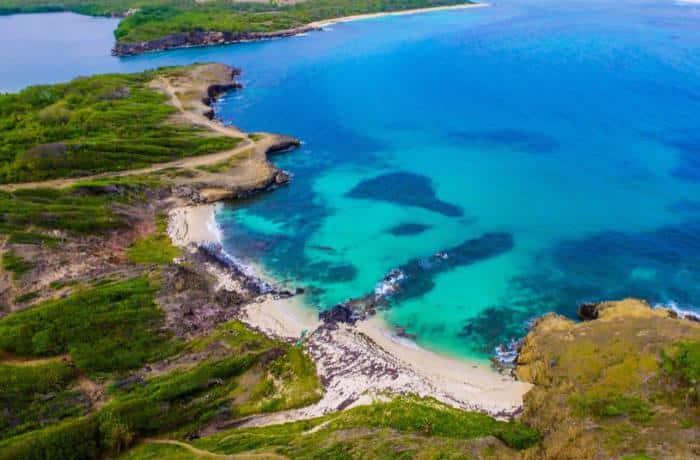
Trace des caps
This is one of the longest hiking trails on the island. The coastal route allows you to discover the beauty of the South Atlantic side, with its coral reefs and its beautiful white sand beaches. This hike is composed of different parts. You can also choose just one of 5 sections: Petit Macabou – Cap Macré (5 km, 2h), Cap Macré – Cap Chevalier (7 km, 3h), Cap Chevalier – Baie des Anglais (6 km, 2h30), Anse Trabaud – Les Salines (5 km, 2h), Les Salines – Anse Caritan (4.5 km, 1h30).
On the way you will pass many interesting spots, such as wild beaches, mangroves, rough nature and breathtaking viewpoints.
It is possible to do the whole hike in one day if you leave early in the morning. Be sure to have enough water and protect yourself against the strong sun.
You can start the hike from Petit Macabou (Vauclin) or from Anse Caritan (Sainte-Anne).
It is best to have two cars and to leave one each on one side.
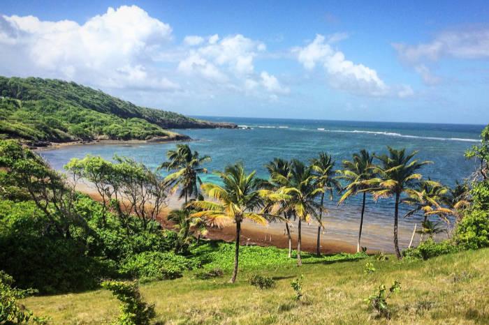
Boucle du Vauclin
This hike is a circle on the Atlantic coast through the mangrove forest and it easy and well marked. It is best to take this walk in sunny weather to see the contrast between the turquoise water and the relief and also to avoid muddy conditions. Once you arrive at Vauclin, follow the Château-Paille/Boucle du Vauclin sign until you arrive at the parking of sport center UCPA. Leave your car here and follow the signs. You will have to first cross a small authentic fishing village. The first part of the hike goes along the Atlantic coast and the nature here is rough and wild, whilst the second part of the circle goes through a mangrove forest. On the way you can enjoy swim and relax at Trou Cochon.
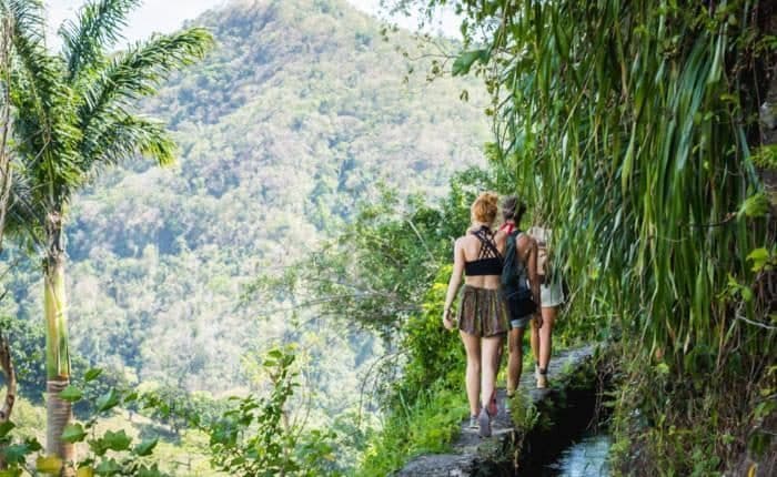
Canal des esclaves
The Canal was designed at the end of the 18th century in order to irrigate the plain by bringing the water of the forest to the Caribbean coast. Hundreds of slaves carried the heavy stones that creates the construction, therefore the place is commonly called the Slave Canal. The hike starts at the dwelling Maison Rousse and follows the canal route. The path goes directly on the wall between water and the valley. Once arrived at the end, you return by the same path in the opposite direction. The route is original but the trail is very narrow so it is not recommended for children or people who are afraid of heights. You should also avoid the trail in rainy weather because the stones become slippery.